Additional Layers
In addition to our standard 2D and standard topo layers, AirWorks also offers a wide selection of add-on layers, all of which can be added to a project at the time you place an order. After you select your bundle, you will be able to manually select one or more of the layers listed below.
As opposed to our standard layers, which are included with your subscription plan and bundle processing, these add-ons are charged on a per-acre basis and need to be paid for via credit-card when placing the order.
List of add-on layers:
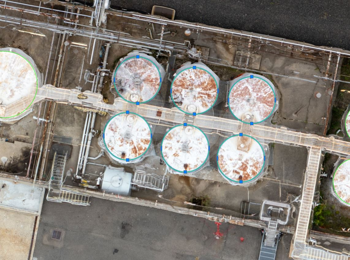
Utility Structures (042) | (Water Tower, Water Tank, Gas Tank) |
|---|---|
AirWorks Layer Name | U-UTILITY-STRUCTURE |
What’s included/classified? | A large, usually cylindrical metal structure of substantial size. A tower supporting a water tank. |
How it’s drafted? | Closed polyline labeled at the outside edge of the structure as determined by surface material. |
Split layer option | None |
|  |
Input data format | .tif |
Input data quality requirements | GSD – 0.25′ minimum, 0.16′ recommended Distortion – 4 minimum, 5 recommended |
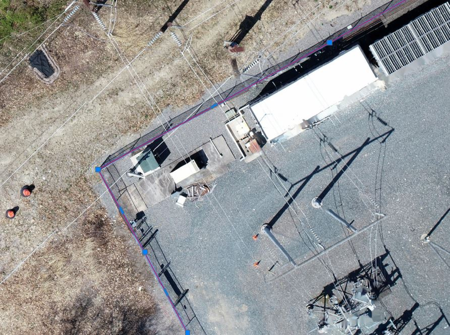
Utility Boxes (043) | (Generator, Transformer, Telecom, Traffic Cabinet) |
|---|---|
AirWorks Layer Name | U-UTILITY-BOX |
| Box-shaped enclosure ranging in size from a refrigerator box to a medium size truck located in the vicinity of Roads (Catalog Number 000). |
How it’s drafted? | Closed polyline labeled at the outside edge of the structure as determined by surface material. |
Split layer option | None |
Example | 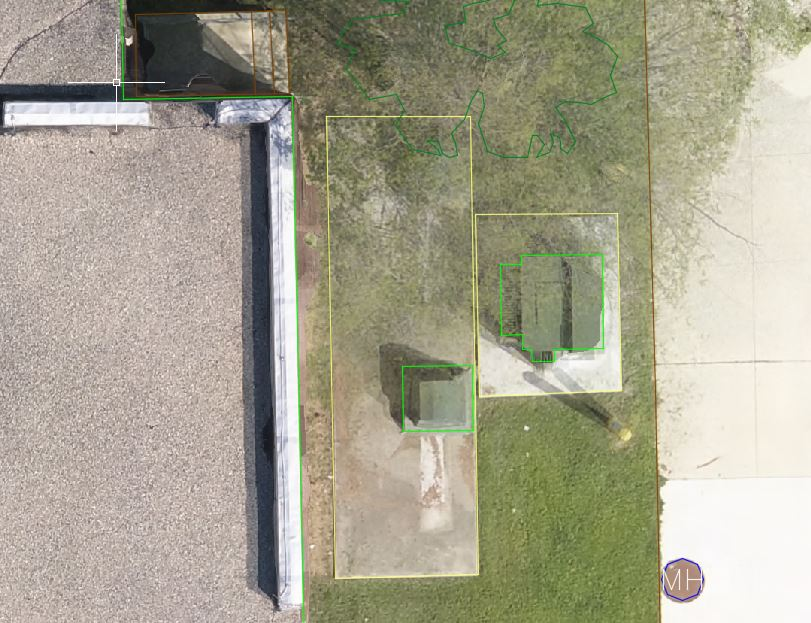 |
Input data format | .tif |
| GSD – 0.08′ minimum, 0.04′ recommended Distortion – 4 minimum, 5 recommended |
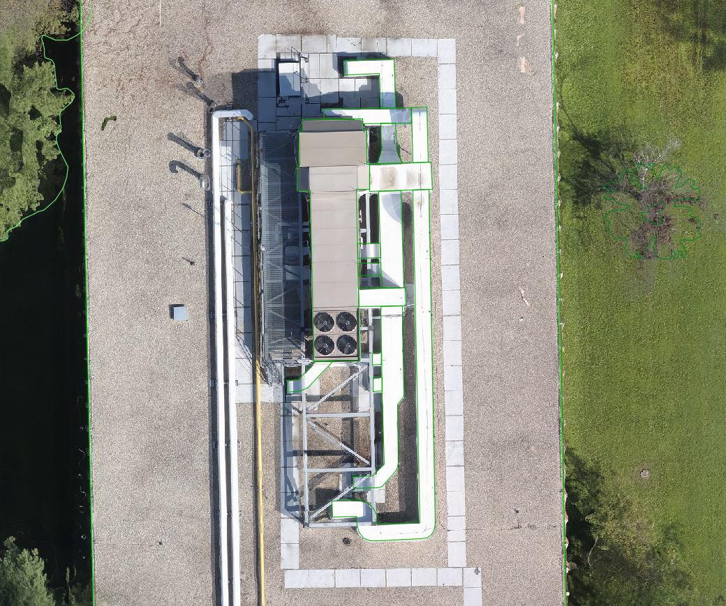
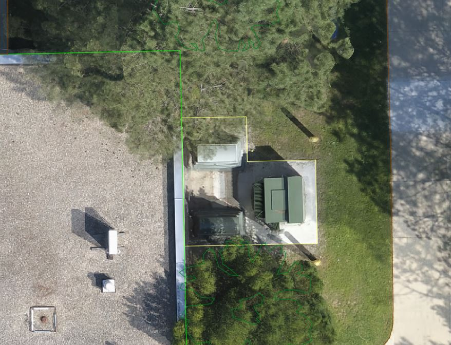
Utility Roof Structures (043) | (HVAC) |
|---|---|
AirWorks Layer Name | U-UTILITY-ROOF |
What’s included/classified? | Heating, ventilation, and air conditioning (HVAC) enclosures located on the top of a building. |
How it’s drafted? | Closed polyline labeled at the outside edge of the structure as determined by surface material. |
Split layer option | None |
|  |
Input data format | .tif |
| GSD – 0.16′ minimum, 0.08′ recommended Distortion – 4 minimum, 5 recommended |
Solar Panels (045) | |
|---|---|
AirWorks Layer Name | U-SOLAR |
What’s included/classified? | A panel designed to convert sunlight to utility power or used for heating purposes. Ground-standing panels only. |
How it’s drafted? | Closed polyline labeled at the outside edge of the structure as determined by surface material. |
Split layer option | None |
| 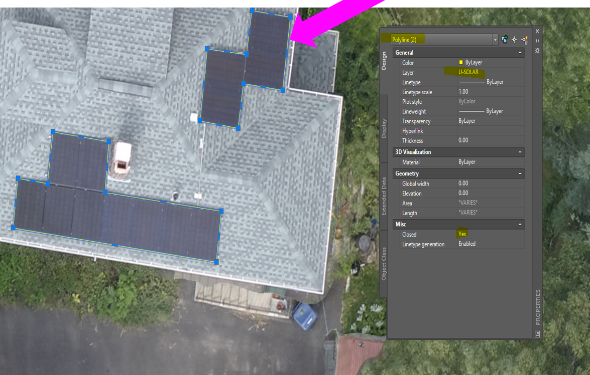 |
Input data format | .tif |
| GSD – 0.5′ minimum, 0.25′ recommended Distortion – 3 minimum, 4 recommended |
Fire Hydrants (046) | |
|---|---|
AirWorks Layer Name | U-HYDRANT |
What’s included/classified? | A valve-controlled spout from which underground utility water may be drawn. Excludes standpipes. |
How it’s drafted? | Block placed at center of unit, not scaled to edge. |
Split layer option | None |
|  |
Input data format | .tif |
Input data quality requirements | GSD – 0.08′ minimum, 0.04′ recommended Distortion – 4 minimum, 5 recommended |
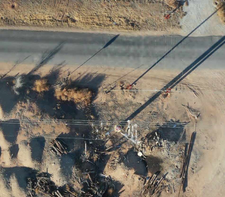
Utility Poles (047) | (Traffic, Telephone, Light) |
|---|---|
AirWorks Layer Name | U-POLE |
What’s included/classified? | A tall pole used to carry power utility wires above the ground, and any equipment mounted thereon. For transmission pylons see Catalog Number 049. |
How it’s drafted? | Block placed at center of unit, not scaled to edge. |
Split layer option | None |
|  |
Input data format | .tif |
| GSD – 0.16′ minimum, 0.08′ recommended Distortion – 4 minimum, 5 recommended |
Overhead Wires (048) | |
|---|---|
AirWorks Layer Name | U-OVERHEAD-WIRE |
| Pole-supported distribution level overhead power utility wires. For transmission lines, see Catalog Number 049. |
How it’s drafted? | Single polyline starting at the center of a utility pole block, and extending to the center of the next utility pole block. |
Split layer option | None |
Example |  |
Input data format | .tif |
| GSD – 0.16′ minimum, 0.08′ recommended Distortion – 4 minimum, 5 recommended |
Transmission Pylons & Poles (049) | |
|---|---|
AirWorks Layer Name | U-TRANSMISSION-POLE U-TRANSMISSION-WIRE |
| Transmission pylons support high-voltage overhead power lines, usually within a utility right-of-way. Includes power lines. For distribution-level utility poles and wires see Catalog Numbers 047 and 048, respectively. |
| Pylon/Pole: Block placed at center of unit, not scaled to edge. Wire: Single polyline starting at the center of a utility pole block, and extending to the center of the next utility pole block. |
Split layer option | None |
|  |
Input data format | .tif |
Input data quality requirements | GSD – 0.25′ minimum, 0.16′ recommended Distortion – 4 minimum, 5 recommended |
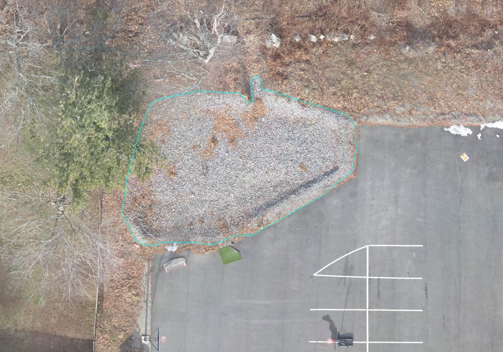
Gravel (038) | |
|---|---|
AirWorks Layer Name | V-GRAVEL |
What’s included/classified? | A loose aggregation of small stones. |
| Closed polyline labeled at the outside edge of the gravel as determined by surface material. Where there is no defined edge, the line will follow where the surface material is distinguishable. |
Split layer option | None |
|  |
Input data format | .tif |
Input data quality requirements | GSD – 0.16′ minimum, 0.08′ recommended Distortion – 4 minimum, 5 recommended |
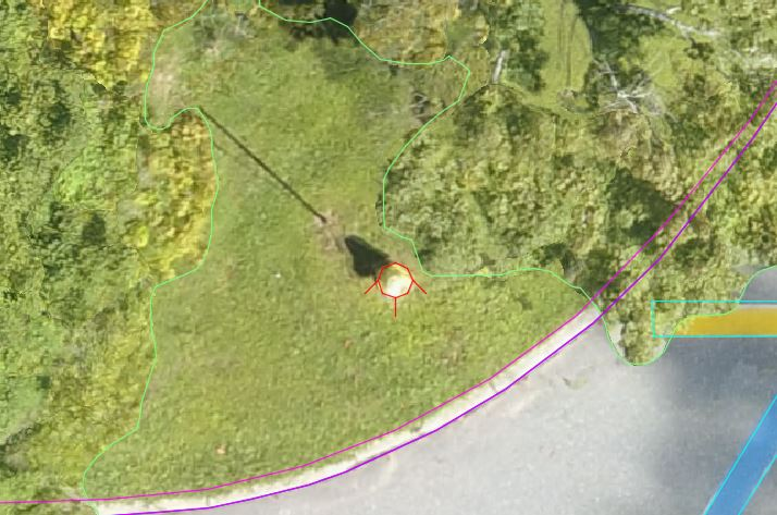
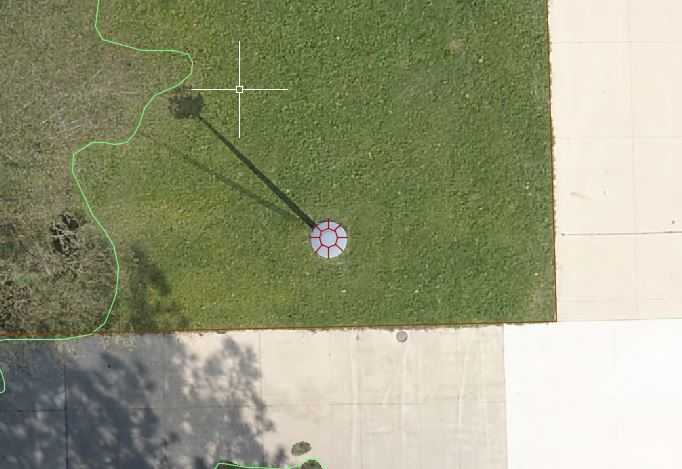
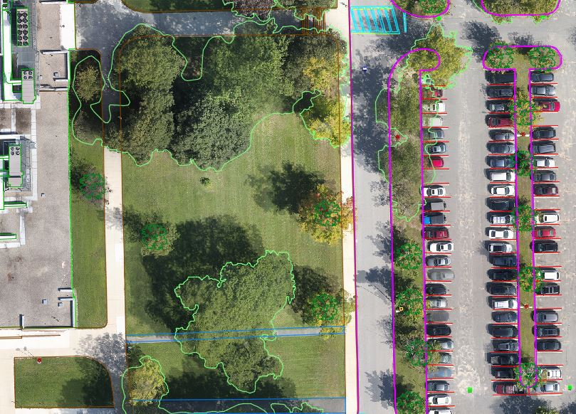
Vegetation Split (039) | Single Trees, Tree Lines, Bushes, Shrub Lines, Landscape Areas |
|---|---|
AirWorks Layer Name | V-STREE V-TREELINE V-LANDSCAPE V-BUSH |
| Single Trees: Any distinct singular tree not in contact with any other vegetation. Tree Lines: A group of Single Trees of any size and shape for which the extent of individual trees cannot be identified. Bushes: Any distinct individual bush not in contact with any other vegetation. Shrub Lines: A group of Bushes of any shape for which the extent of individual bushes cannot be identified. Landscape Areas: Manually-maintained areas of land consisting of planted shrubs, trees, or other vegetation. |
| Single Trees: Block placed at the apparent center of the canopy. Tree Lines: Closed polyline labeled at the outside edge of the vegetation canopy (edge of leaves or branches). Bushes: Block placed at the apparent center of the canopy. Shrub Lines: Closed polyline labeled at the outside edge of the vegetation canopy (edge of leaves or branches). Landscape Areas: Closed polyline labeled at the outside edge of the landscape area as determined by surface material. Where there is no defined edge, the line will follow where the surface material is distinguishable. |
Split layer option | Split into the layers above |
|  |
Input data format | .tif |
| GSD – 0.16′ minimum, 0.08′ recommended Distortion – 4 minimum, 5 recommended |
3D Building Footprints (020) | |
|---|---|
AirWorks Layer Name | B-FOOTPRINT |
What’s included/classified? | Outline of the base of a building or any other occupiable structure. |
| Closed polyline labeled at the outside edge of the location where the building and ground appear to intersect. We interpolate through obstructions over a short distance (i.e. under vegetation). Sections will be left blank if unable to interpret. |
Split layer option | None |
Example | None |
Input data format | .las |
| RMSEz – 0.32′ min GSD Source Imagery – 0.32′ min, 0.16′ recommended |
Concrete Pad (021) | |
|---|---|
AirWorks Layer Name | C-CONC-PAD |
What’s included/classified? | Any concrete surface typically used for equipment and structures. |
| Closed polyline labeled at the outside edge of the concrete as determined by surface material. We interpolate through obstructions over a short distance (i.e. under Vegetation) |
Split layer option | None |
|  |
Input data format | .tif |
| GSD – 0.16′ minimum, 0.08′ recommended Distortion – 4 minimum, 5 recommended |
Railroad (029) | |
|---|---|
AirWorks Layer Name | R-RAILROAD |
What’s included/classified? | A track or set of tracks consisting of parallel rails intended for railroad vehicles. |
| Single polyline labeled at the center of each rail. For 3D (top of rail) approximate elevation/z-value added for each node along the polyline. We interpolate through obstructions over a short distance (i.e. under Vegetation) |
Split layer option | eNone |
| 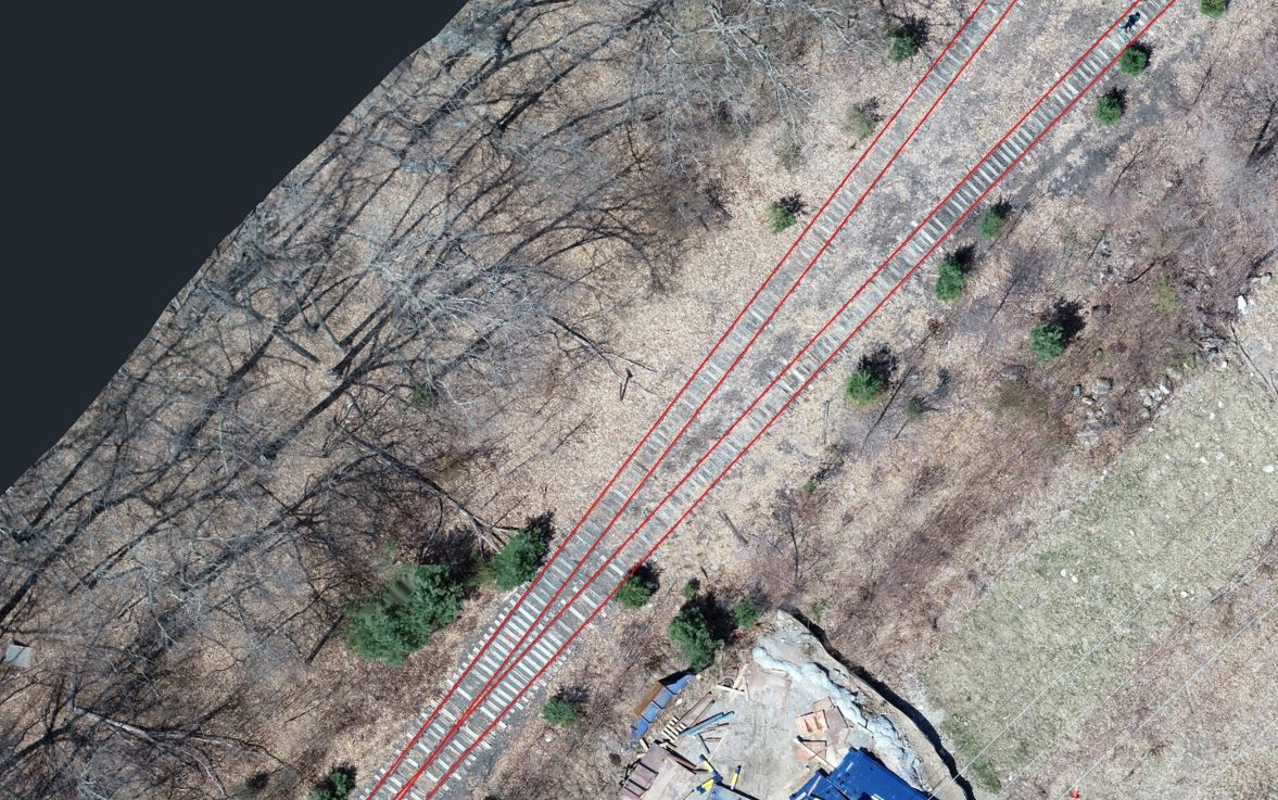 |
| .tif (2D) .las (3D) |
| GSD – 0.16′ minimum, 0.08′ recommended Distortion – 4 minimum, 5 recommended (3D Only) RMSEz – 0.1′ min |
Docks (036) | (Piers & Gangway) |
|---|---|
AirWorks Layer Name | S-DOCK |
What’s included/classified? | A structure extending alongshore or outwards from the shore into a body of water. |
How it’s drafted? | Closed polyline labeled at the outside edge of the dock as determined by surface material. |
Split layer option | None |
| 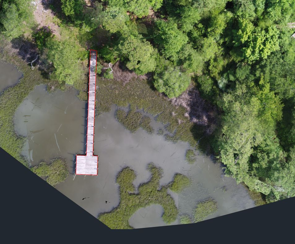 |
Input data format | .tif |
| GSD – 0.25′ minimum, 0.16′ recommended Distortion – 4 minimum, 5 recommended |
Decks (037) | |
|---|---|
AirWorks Layer Name | S-BUILDING-FEATURE |
What’s included/classified? | A wood or composite platform connected to a Building (Catalog Number 003). |
How it’s drafted? | Closed polyline labeled at the outside edge of the deck as determined by surface material. |
Split layer option | None |
| 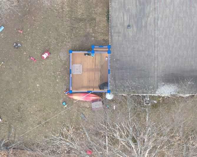 |
Input data format | .tif |
| GSD – 0.25′ minimum, 0.16′ recommended Distortion – 4 minimum, 5 recommended |
Walls (032) | |
|---|---|
AirWorks Layer Name | S-WALL |
What’s included/classified? | A freestanding linear structure made of stone or concrete intended to be a barrier or retainer. |
How it’s drafted? | Closed polyline labeled at the outside edge of the front and back of wall as determined by surface material. We interpolate through obstructions over a short distance (i.e. under Vegetation) |
Split layer option | Stone Walls, Concrete Walls |
| 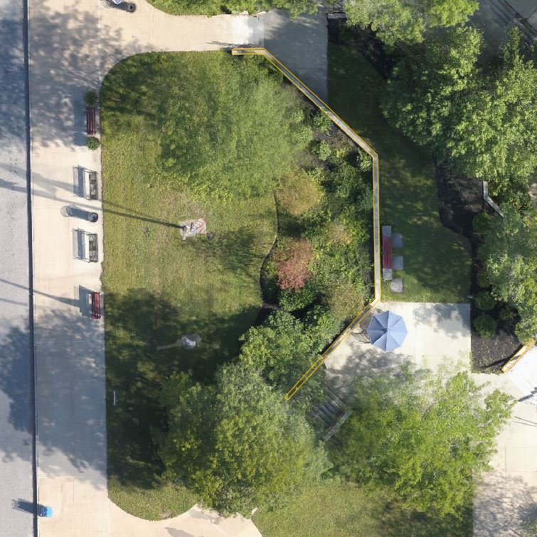 |
Input data format | .tif |
| GSD – 0.25′ minimum, 0.16′ recommended Distortion – 4 minimum, 5 recommended |
Wall Split | |
|---|---|
AirWorks Layer Name | S-WALL-CONC S-WALL-STONE |
What’s included/classified? | A freestanding linear structure made of stone or concrete intended to be a barrier or retainer. |
How it’s drafted? | Closed polyline labeled at the outside edge of the front and back of wall as determined by surface material. We interpolate through obstructions over a short distance (i.e. under Vegetation) |
Split layer option | Split into the layers listed above |
Example | 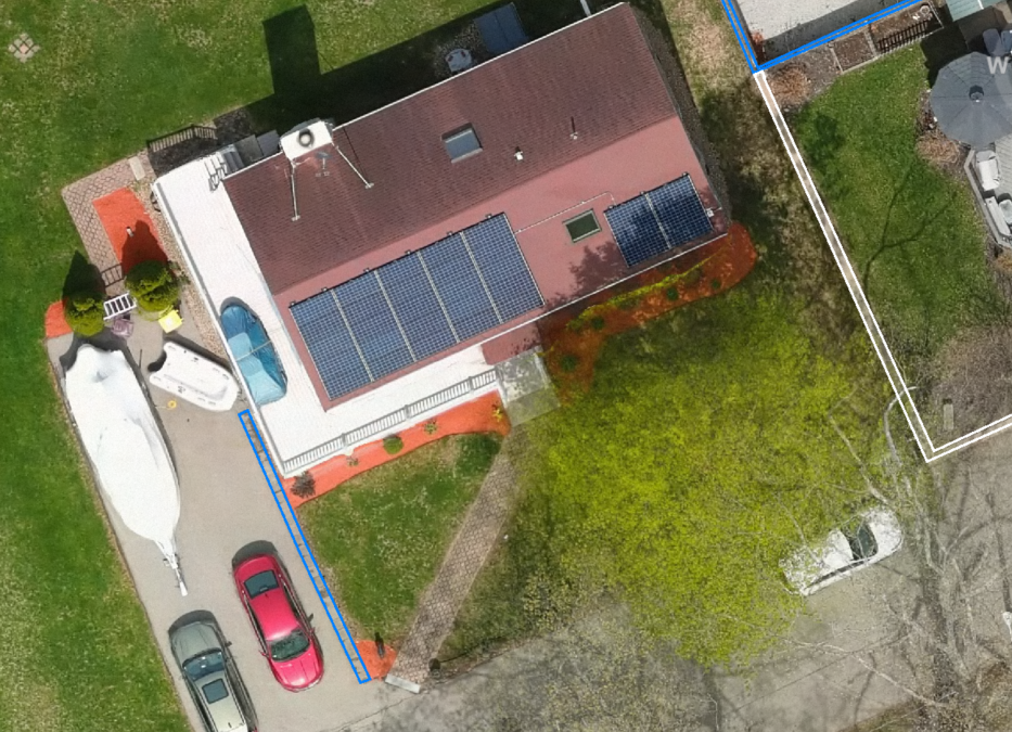 |
Input data format | .tif |
Input data quality requirements | GSD – 0.16′ minimum, 0.08′ recommended |
Fences (034) | |
|---|---|
AirWorks Layer Name | S-FENCE |
What’s included/classified? | A freestanding linear structure made of vinyl or wood intended to form a boundary. |
| Single polyline labeled at the center of fence. We interpolate through obstructions over a short distance (i.e. under Vegetation) |
Split layer option | Fence Lines, Guard Rails, Railings |
|  |
Input data format | .tif |
Input data quality requirements | GSD – 0.16′ minimum, 0.08′ recommended |
Fence Split | |
|---|---|
AirWorks Layer Name | S-FENCE S-GUARDRAIL S-RAILING |
What’s included/classified? | Single polyline labeled at the center of fence. We interpolate through obstructions over a short distance (i.e. under Vegetation) |
How it’s drafted? | Fence Lines: A freestanding linear structure made of vinyl or wood intended to form a boundary. Guard Rails: A freestanding linear structure at the side of a road intended to form a barrier. Railings: A freestanding linear structure at the side of a walking surface intended to form a barrier. |
Split layer option | Split into the layers listed above |
Example | 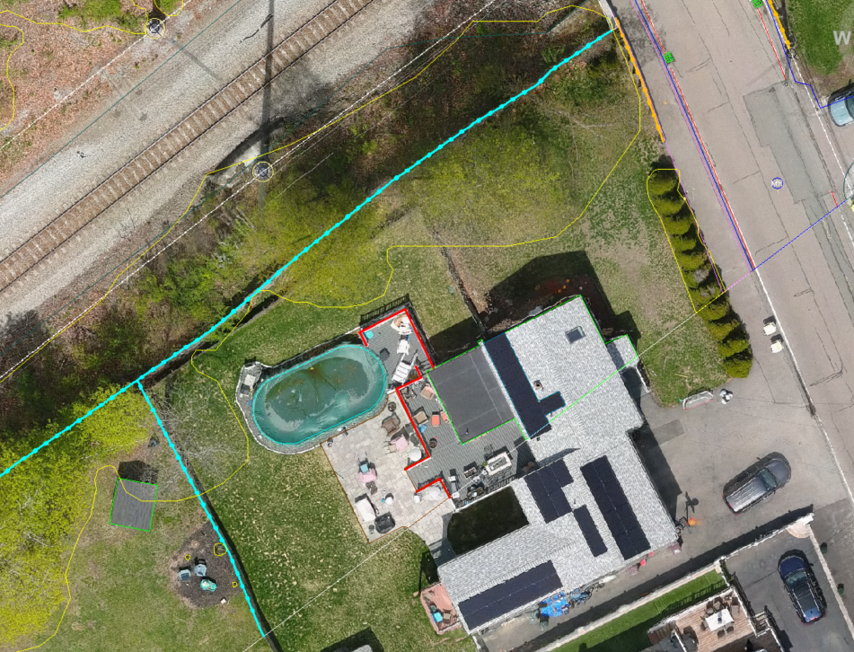 |
Input data format | .tif |
Input data quality requirements | GSD – 0.16′ minimum, 0.08′ recommended |
Pavement Markings (004) | |
|---|---|
AirWorks Layer Name | R-PAVEMARK |
What’s included/classified? | Any painted markings visible on Roads (Catalog Number 000). |
How it’s drafted? | This layer is delivered in three different possible formats; single polyline labeled at the centerline of thin pavement markings, closed polyline labeled at the outside edge of thick pavement markings, closed polyline labeled at the outside edge of pavement marking symbols and lettering. We interpolate through obstructions over a short distance (i.e. under cars). |
Split layer option | None |
Example | 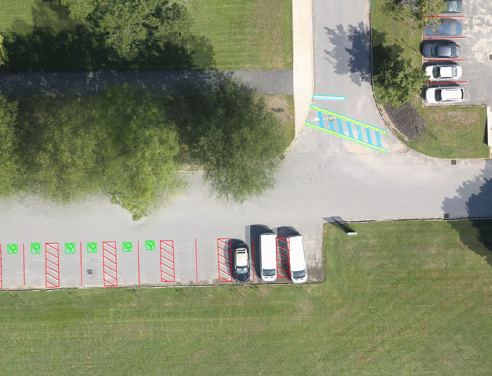 |
Input data format | .tif |
Input data quality requirements | GSD – 0.25′ minimum, 0.16′ recommended (symbols and text require under 0.1′) Distortion – 3 minimum, 4 recommended |
Golf Course Split (Tee, Green, Fairway, Bunker) | |
|---|---|
AirWorks Layer Name | G-BUNKER G-FAIRWAY G-GREEN G-TEEBOX |
What’s included/classified? | Golf course Bunkers, Fairways, Greens, and Teebox areas. Examples given on labeled image below. 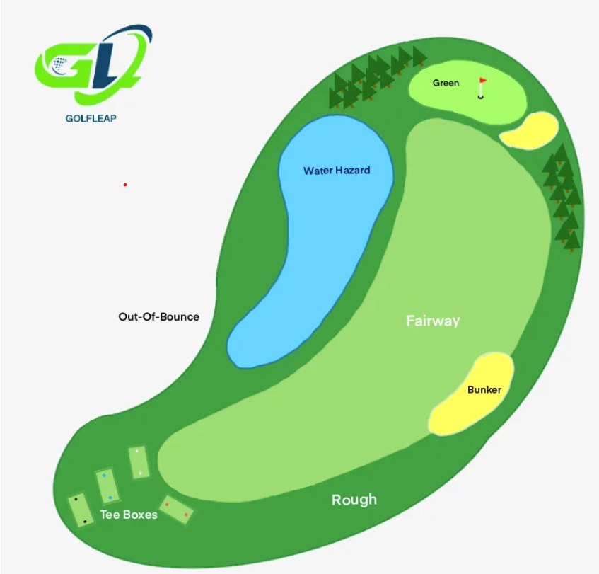 |
How it’s drafted? | Closed polyline labeled at the outside edge of each area type as determined by surface material. |
Split layer option | Split into the layers listed above |
Example | 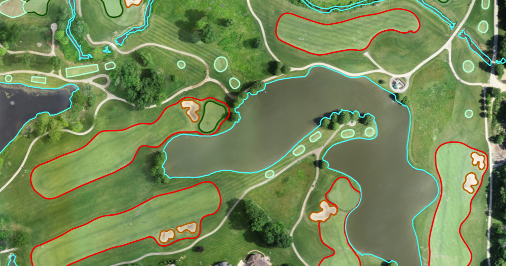 |
Input data format | .tif |
Input data quality requirements | GSD – 0.25′ minimum, 0.16′ recommended Distortion – 4 minimum, 5 recommended |
Center of Road | (Available under Utilities package) |
|---|---|
AirWorks Layer Name | A_ROAD_CENTERLINE |
What’s included/classified? | |
How it’s drafted? | Polyline representing the centerline of the road areas |
Split layer option | None |
Example | |
Input data format | .tif |
Input data quality requirements |
RR crossing | (Available under Utilities package) |
|---|---|
AirWorks Layer Name | |
What’s included/classified? | |
How it’s drafted? | |
Split layer option | None |
Example | |
Input data format | |
Input data quality requirements |
Ditches | (Available under Utilities package) |
|---|---|
AirWorks Layer Name | |
What’s included/classified? | |
How it’s drafted? | |
Split layer option | None |
Example | |
Input data format | |
Input data quality requirements |
Road & Sidewalk | (Available under Utilities package) |
|---|---|
AirWorks Layer Name | R_ROAD_CONC |
What’s included/classified? | Sidewalks Split - Asphalt, Concrete, Paver, Gravel, Unpaved |
How it’s drafted? | Closed polylines (Polygon areas) for Road areas by material |
Split layer option | None |
Example | |
Input data format | .tif |
Input data quality requirements |
Gutter | (Available under Utilities package) |
|---|---|
AirWorks Layer Name | |
What’s included/classified? | |
How it’s drafted? | |
Split layer option | None |
Example | |
Input data format | |
Input data quality requirements |
Underground Heavy Bundle under “Utilities” package will have extra additional layers for selection as below: