
Standard Topo Layers
The list of layers below includes our standard topography layers, which will be automatically included in every project when you select “Topo” or “2D + Topo” in the order form during project check-out.
Major and Minor Contours (009)
| G-TOPO-MAJR G-TOPO-MINR |
What’s included/ classified? | Graduating lines depicting changes in elevation. |
| Polylines labeled along elevation at intervals as determined by the contour interval. Built from ground segmented point cloud. We interpolate through obstructions over a short distance (i.e. under Vegetation). |
Split Layer Option | None |
Example | 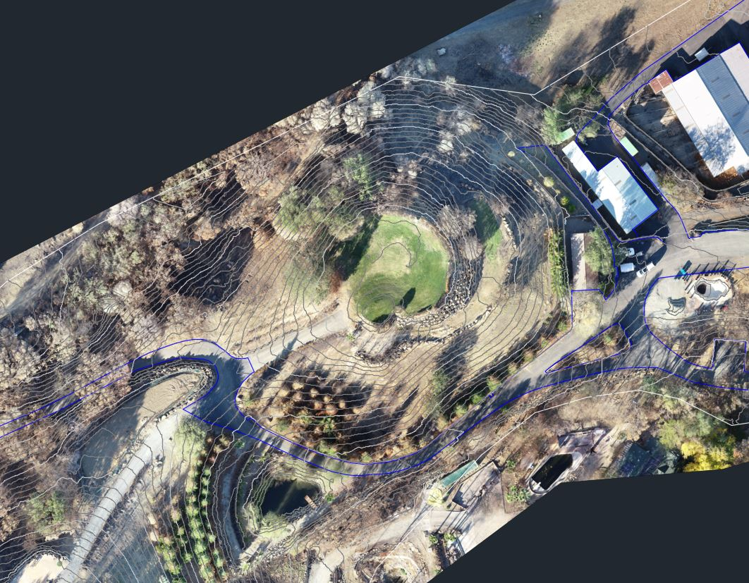 |
Input data format | .las |
| 1’/5′ (minor/major) RMSEz – 0.32′ min GSD Source Imagery – 0.32′ min, 0.16′ recommended 2’/10′ (minor/major) RMSEz – 0.65′ min GSD Source Imagery – 0.65′ min, 0.32′ recommended |
Obstruction (019)
AirWorks Layer Name | A-OBSTRUCTION |
What’s included/classified? | Areas obstructing ground segmentation. All large “no data” regions in the ground classified point cloud. Note: Water will return data but is removed from the ground classified point cloud. |
| Closed polyline labeled at the outside edge of the ‘no data’ region in the ground classified point cloud. A radius of 5 pixels (more than 10×10 pixels wide) is shown on the layer. |
Split Layer Option | None |
| 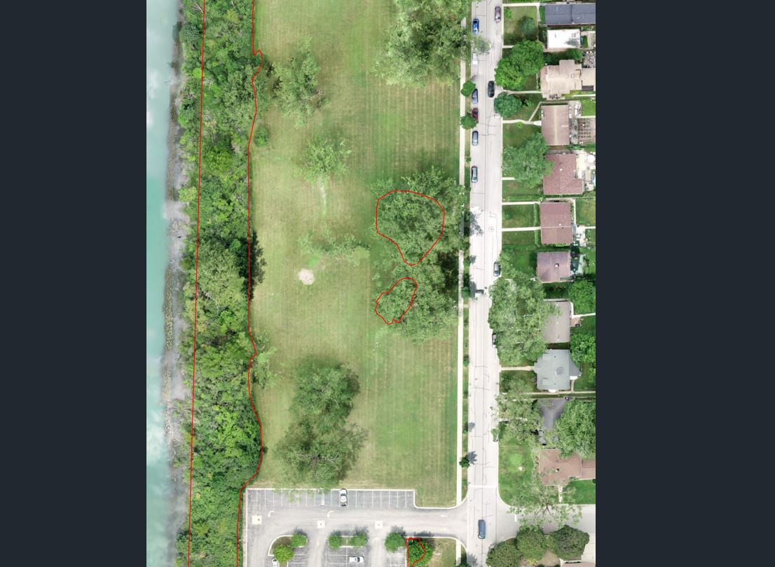 |
Input data format | .las |
| GSD Source Imagery |