
Standard 2D Layers
The list of layers below includes our standard planimetrics layers, which will be automatically included in every project when you select “2D” or “2D + Topo” in the order form during project check-out.
Roads (000)
AirWorks Layer Name | R-ROAD |
What’s included/classified? | Any paved surface intended for use by street-legal vehicles. Includes parking areas and driveways. |
How it’s drafted? | Closed polyline labeled at the outside edge of the pavement as determined by surface material. We interpolate through obstructions over a short distance (i.e. under Vegetation) |
Split layer option | Asphalt, concrete, paver (stone, brick, wood) |
Example | 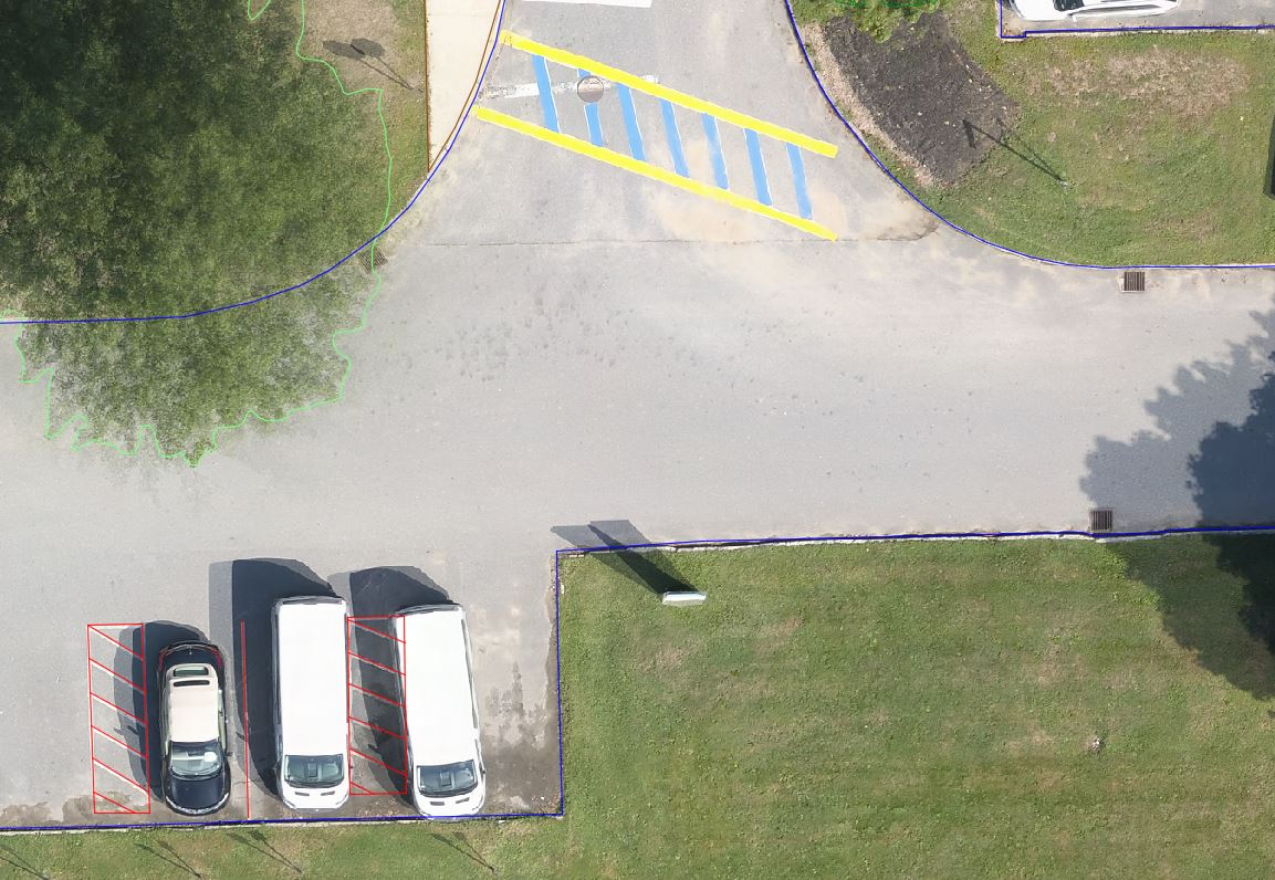 |
Input data format | .tif |
Input data quality requirements | GSD – 0.5′ minimum, 0.25′ recommended Distortion – 3 minimum, 4 recommended |
Sidewalks (001)
AirWorks Layer Name | R-WALK |
What’s included/classified? | Any paved path intended for pedestrians. |
How it’s drafted? | Closed polyline labeled at the outside edge of the pavement as determined by surface material. We interpolate through obstructions over a short distance (i.e. under Vegetation) |
Split layer option | Asphalt, concrete, paver (stone, brick, wood) |
Example | 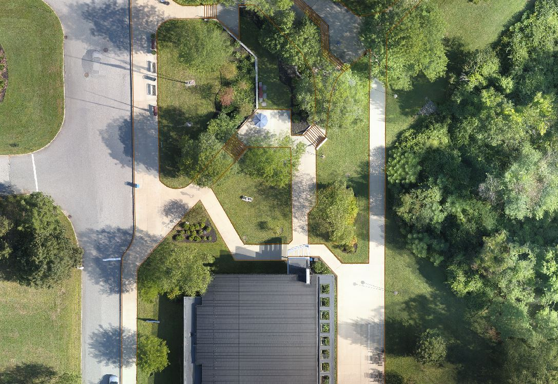 |
Input data format | .tif |
| GSD – 0.5′ minimum, 0.25′ recommended Distortion – 3 minimum, 4 recommended |
Curbs (002)
AirWorks Layer Name | R-CURB |
What’s included/classified? | Any edging to a paved surface. |
| Closed polyline labeled at the outside edge of the front and back of curb as determined by surface material. Includes parking curbs. We interpolate through obstructions over a short distance (i.e. under Vegetation) |
Split layer option | Curb, Berm |
Example | 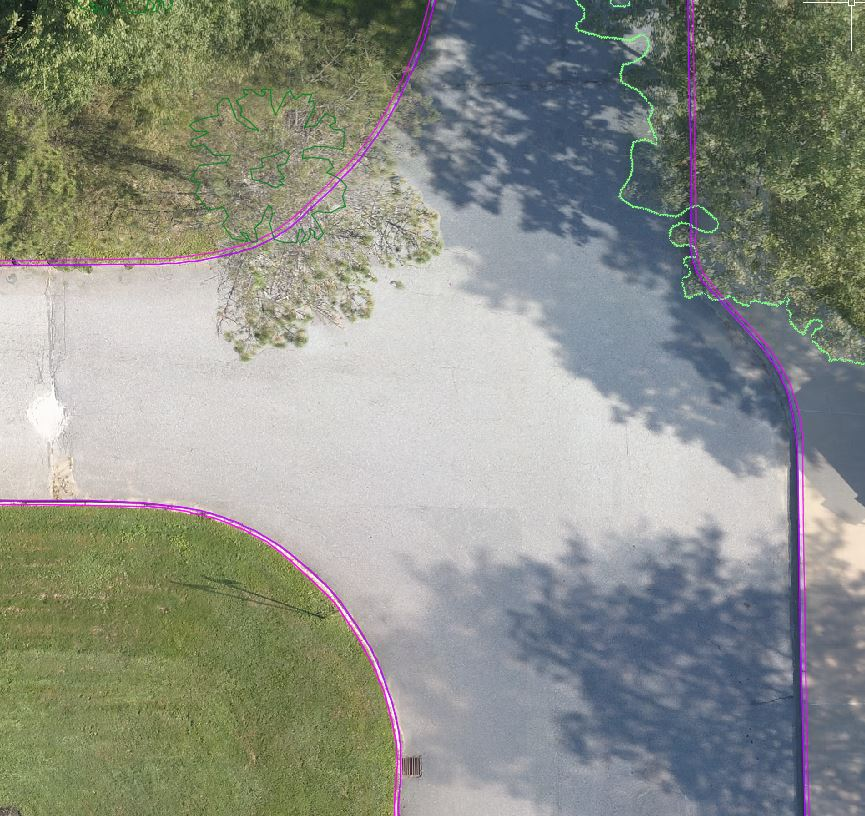 |
Input data format | .tif |
| GSD – 0.25′ minimum, 0.16′ recommended Distortion – 4 minimum, 5 recommended |
Buildings (003)
AirWorks Layer Name | B-OVERHANG |
What’s included/classified? | Outline of the roof of a building and other attached overhangs and/or any occupiable structure that obstructs view of the ground. |
How it’s drafted? | Closed polyline labeled at the outside edge of the structure overhang. |
Split layer option | None |
Example | 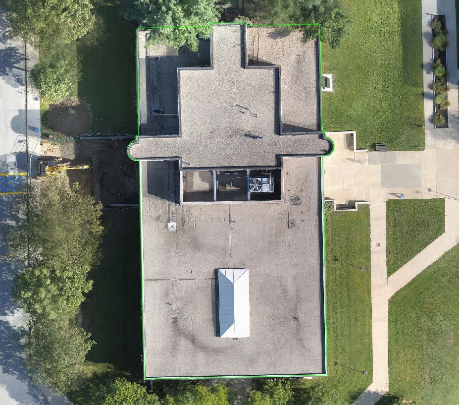 |
Input data format | .tif |
| GSD – 0.5′ minimum, 0.25′ recommended Distortion – 3 minimum, 4 recommended |
Pavement Markings (004)
AirWorks Layer Name | R-PAVEMARK-LINE R-PAVEMARK-POLY R-PAVEMARK-SYMBOL |
What’s included/classified? | Any painted markings visible on Roads (Catalog Number 000) |
How it’s drafted? | LINES: Single polyline labeled at the centerline of thin pavement markings POLYS: Closed polylines labeled at the outside edge of thick pavement markings SYMBOLS: Closed Polyline labeled at the outside edge of pavement marking symbols and lettering We interpolate through obstructions over a short distance (i.e. under Vegetation) |
Split layer option | Split into the layers noted above |
Example | 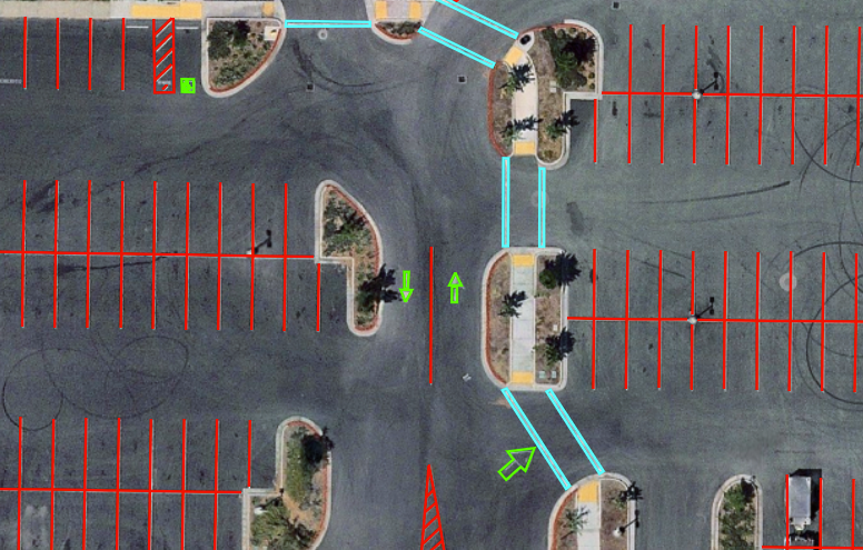 |
Input data format | .tif |
Input data quality requirements | GSD – 0.25′ minimum, 0.16′ recommended (symbols and text require under 0.1′) Distortion – 3 minimum, 4 recommended |
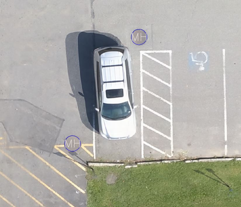
Manholes (005)
AirWorks Layer Name | U-MANHOLE |
| A circular-covered personnel access entry to underground utility (not including utility gates or similar structures). Any spherical access feature over 1.33 feet / 0.4 meters in diameter is considered a manhole. Features under those dimensions will not be included in the output DXF. These typically include valves, gates, meters, handholes etc. |
| Block placed at center scaled to rim extents of the manhole cover. |
Split layer option | None |
|  |
Input data format | .tif |
| GSD – 0.25′ minimum, 0.16′ recommended Distortion – 4 minimum, 5 recommended |
Catch Basins (006)
AirWorks Layer Name | U-CATCHBASIN |
What’s included/classified? | Any grated cover over an underground utility space. |
| Block placed at center scaled to rim extents of the catchbasin cover. We do not interpolate through obstructions. |
Split layer option | None |
|  |
Input data format | .tif |
| GSD – 0.25′ minimum, 0.16′ recommended Distortion – 4 minimum, 5 recommended |
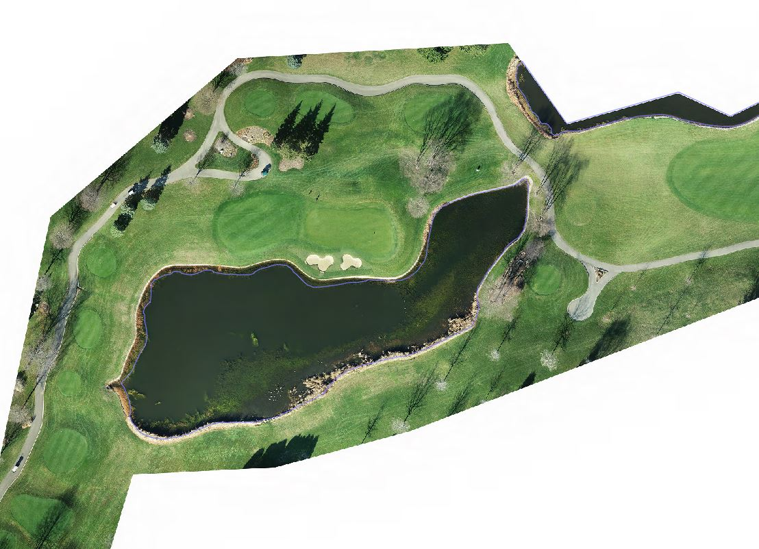
Water (007)
AirWorks Layer Name | W-WATER |
What’s included/classified? | Any permanently located body of water. |
How it’s drafted? | Closed polyline labeled at the outside edge of the water. (Includes pools, rivers, lakes, canal, or exposed tank). We interpolate through obstructions over a short distance (i.e. under Vegetation). |
Split Layer Option | None |
|  |
Input data format | .tif |
| GSD – 0.25′ minimum, 0.16′ recommended Distortion – 4 minimum, 5 recommended |
Vegetation (008)
AirWorks Layer Name | V-VEGETATION |
What’s included/classified? | All vegetation taller than 0.5 feet. |
How it’s drafted? | Closed polyline labeled at the outside edge of the vegetation canopy (edge of leaves or branches). |
Split layer option | Single trees, tree lines, bushes, prepared beds, shrub lines, mowed grass, and landscaped area |
Example | 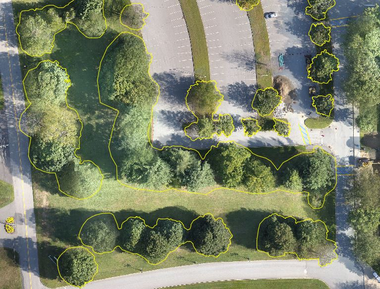 |
Input data format | .tif |
| GSD – 0.5′ minimum, 0.25′ recommended Distortion – 3 minimum, 4 recommended |
Concrete Pad (021)
AirWorks Layer Name | C-CONC-PAD |
What’s included/classified? | Any concrete surface typically used for equipment and structures. |
How it’s drafted? | Closed polyline labeled at the outside edge of the concrete as determined by surface material. We interpolate through obstructions over a short distance (i.e. under Vegetation) |
Split layer option | None |
Example | 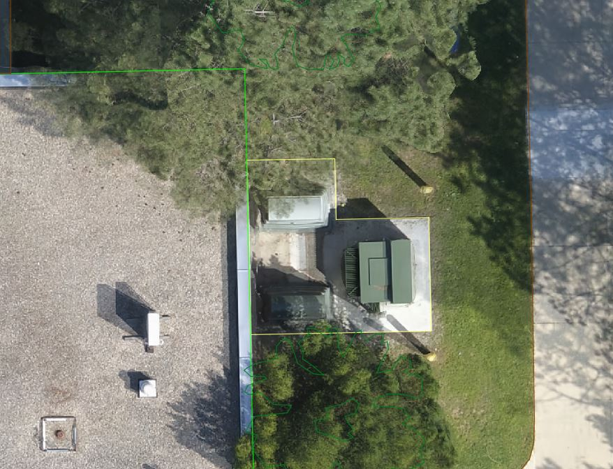 |
Input data format | .tif |
Input data quality requirements | GSD – 0.16′ minimum, 0.08′ recommended Distortion – 4 minimum, 5 recommended |