
Step 12: The AirWorks Data Marketplace
Read our One Pager on the AirWorks Data Marketplace here
Here’s how it works:
1. Draw or upload a KML for your Area of Interest.

2. Request Imagery from the sidebar of your project details tab by clicking on the “Check Imagery Availability” button.
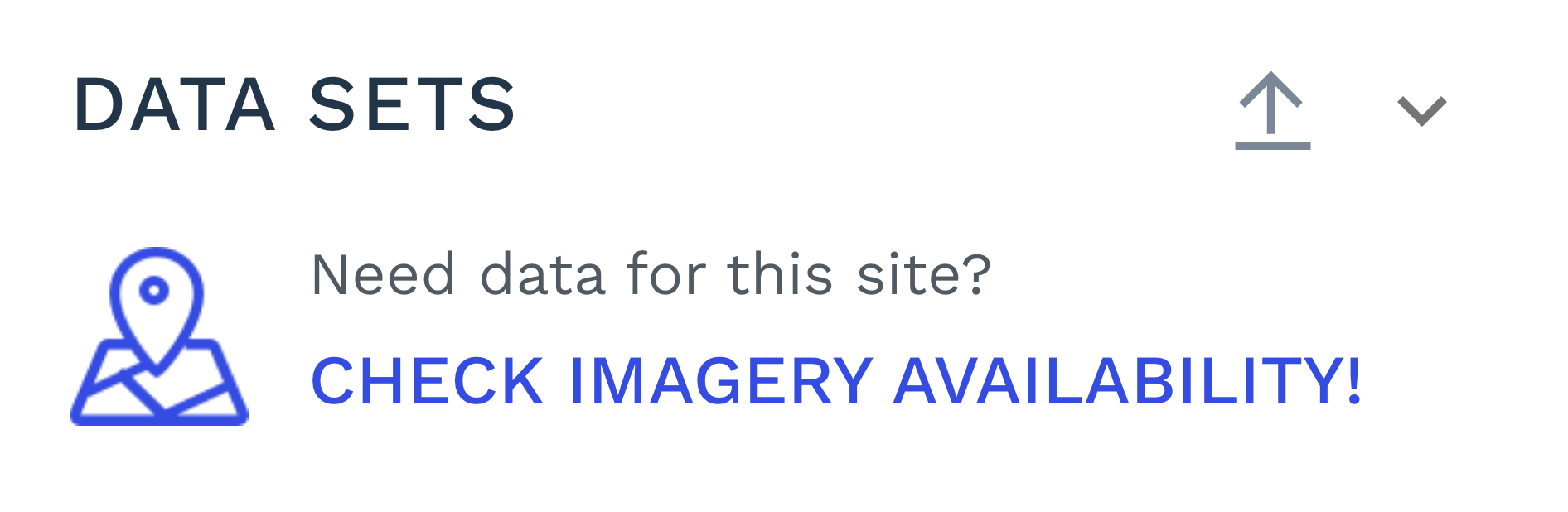
Once the check is complete, if imagery is available, you can request imagery by clicking on the “Request Imagery!” button.

View our catalogue of data providers. Currently, you are defaulted to Nearmap’s data.
Enter your desired Projection system for your data from the Projection dropdown.
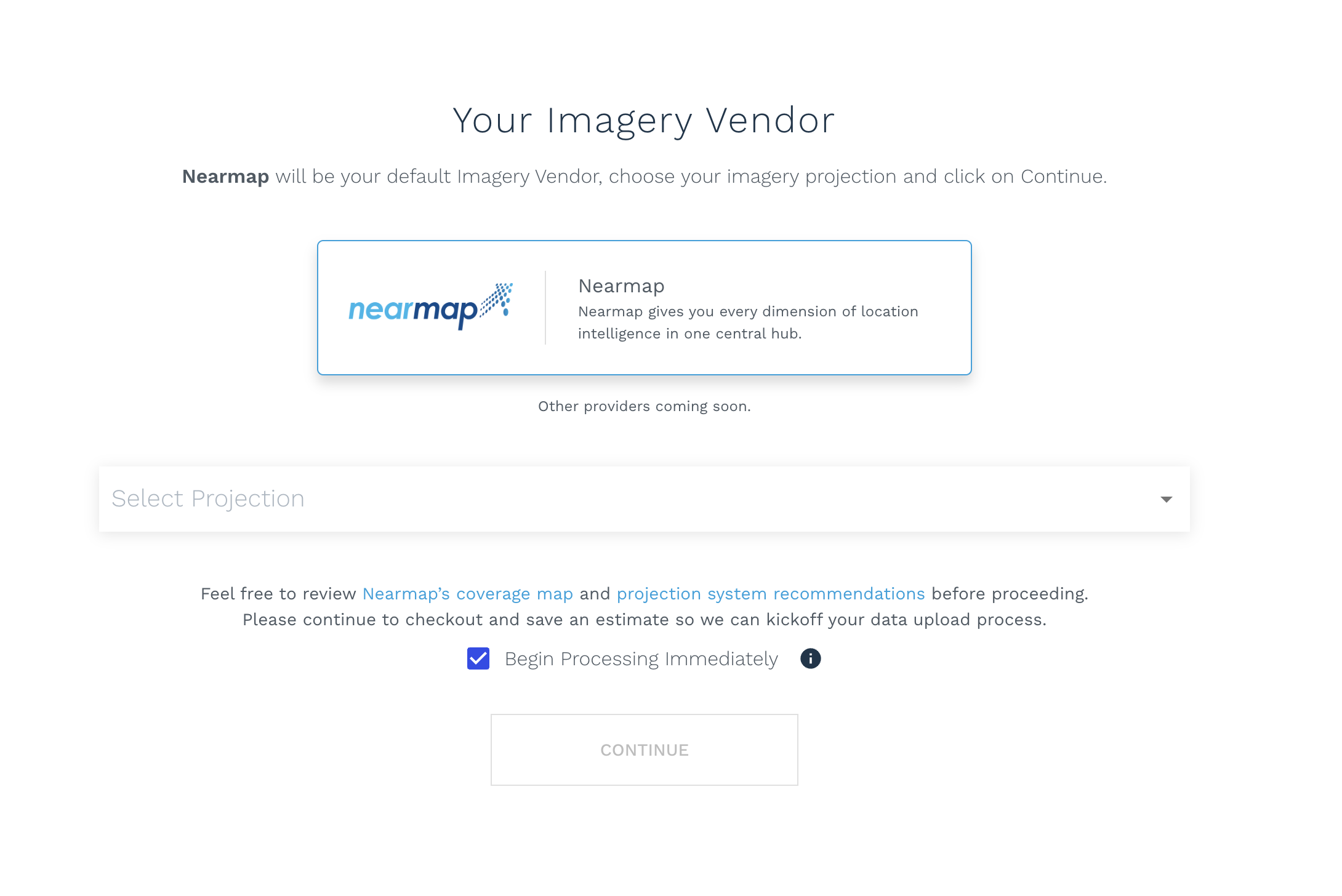
[Optional] Select the “Begin Processing Immediately” checkbox if you would like for your order to be placed and processed immediately.
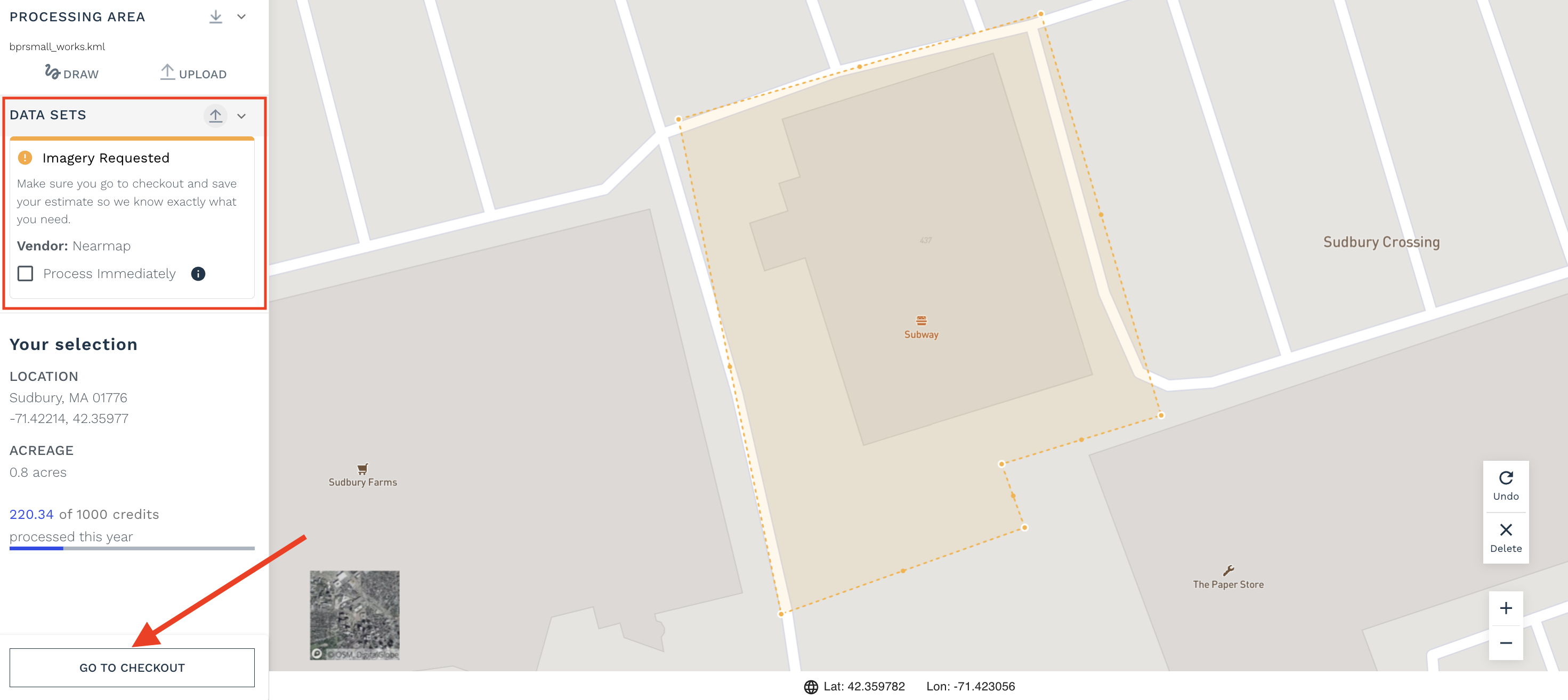
Note: When the “Begin Processing Immediately” option is selected, you are forfeiting your chance to review the available imagery for your area of interest before placing your order. If you want to review the imagery before kicking off your project, unselect this option.You’re almost done! Make sure you go to Checkout, select any add-ons and deliverables you’d like with your order, click on the “Request Imagery” button, and then save the estimate. This part is crucial! You’ll get an email from us confirming your data request, and we’ll upload your imagery within a day.
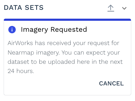
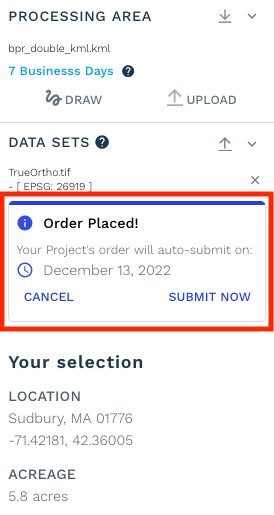
Note that once you have requested the imagery and saved the estimate, your order page should display the following confirmation message. Click on the “Cancel” button if you wish to cancel your imagery request.
Once you receive an email confirming your imagery has been uploaded, your order will be automatically submitted within 24 hours.
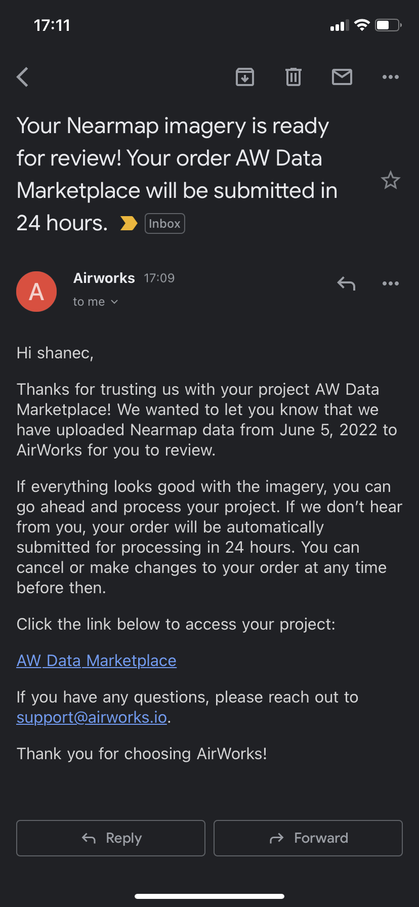
We highly recommend that during the 24 hours, you login and review the imagery. There, you can cancel the order if the imagery does not meet your expectations, or go ahead and submit your order if you want us to get started sooner!
If, for some reason, we cannot locate Nearmap imagery, we will let you know via email and automatically cancel your order.
Frequently asked questions:
1. Where can I view Nearmap’s coverage map?
Nearmap updates their coverage over here: https://www.nearmap.com/us/en/current-aerial-maps-coverage
2. Can I get access to the Nearmap imagery you uploaded to use in other software?
You’re more than welcome to use the AirWorks CAD Editor to view or modify linework generated from Nearmap’s imagery. However, at this point, you are unable to export the imagery from the AirWorks WebApp for use in other software. You can go directly to Nearmap if you need to download the imagery"
3. When will I receive my linework back for an order that I requested imagery for?
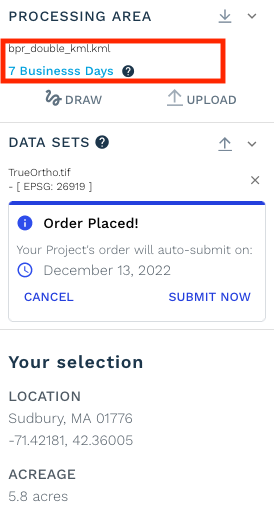
AirWorks' WebApp will tell you how long we’ll take to deliver your linework. This is listed in blue text below your processing area’s filename. Please note, you’ll need to save an estimate after requesting imagery to get an accurate estimate of how long we’ll take to deliver your linework.
4. How do I know what Projection system to choose?
A good rule of thumb is to use a local projection system to your site. The AirWorks Web App will walk you through recommended projection systems that are compatible with Nearmap’s imagery. If you’d like even more information, feel free to review Nearmap’s exhaustive documentation on the subject: https://docs.nearmap.com/display/NUB/2020/02/04/Projections+and+Coordinate+Systems+and+the+Importance+of+the+Coordinates
5. What is the accuracy of Nearmap data?
Please review this information from Nearmap in terms of the quality of their imagery to ensure their data meets your desired use case and quality.
6. Can I get multiple AirWorks orders from one Nearmap image?
Unfortunately, at this time, we cannot create multiple orders from a Nearmap Image or partial image that already has an order associated with it.
7. What are some possible use cases and benefits that I can expect from this AirWorks and Nearmap partnership?
If your design team needs to start their design work and you do not have access to your surveying team, you can use Nearmap imagery with AirWorks intelligence to get your design team engaged and billing faster, by quickly providing them data that provides conceptual insights into their project.
Also, if you need to respond quickly to a Request for Proposal and want to ensure you understand the existing site conditions, using Nearmap imagery with AirWorks intelligence reduces your proposal risk by giving you better insight into the existing conditions of your project. It can possibly increase your chance of winning the project by helping ensure your proposal best meets your customer's expectations since you gain a better understanding of the project conditions.