
Layer Output Confidence Level
We at AirWorks strive to provide the most accurate output for your layers using our state of the art algorithms and our in-house team of CAD engineers. In order to ensure your team receives output .dxfs of the highest quality, we want to share our confidence level in our output for each layer given the input data’s Ground Sampling Distance. You should use this document as a guide post for the level of confidence we have in our output per layer at different ground sampling distances.
.png?inst-v=2b465b96-75e8-4672-8b0d-41b4ca6b0591)
As a rule of thumb, the finer the resolution and the larger the layer for the feature you requested, the higher confidence we have in our output. Certain layers like manholes can only be detected with a high resolution ground sampling distance of ~5 cm. However, for layers like water or vegetation, AirWorks can provide high quality outputs even at GSDs up to 30 CM.
Regardless of the GSD, we will always strive to provide the highest quality output dxfs. If you have questions about your input data, please reach out to your Sales representative. We’d be happy to provide further clarity.
In addition to 2D and topo, there is 3D Elevation and Point cloud data also available as part of deliverables. To understand more on how its quality will be, there is confidence chart available for it as well. There are 3 factors majorly consider to measure accuracy of data i.e. density, noise and spread
Lets see how those will look alike:
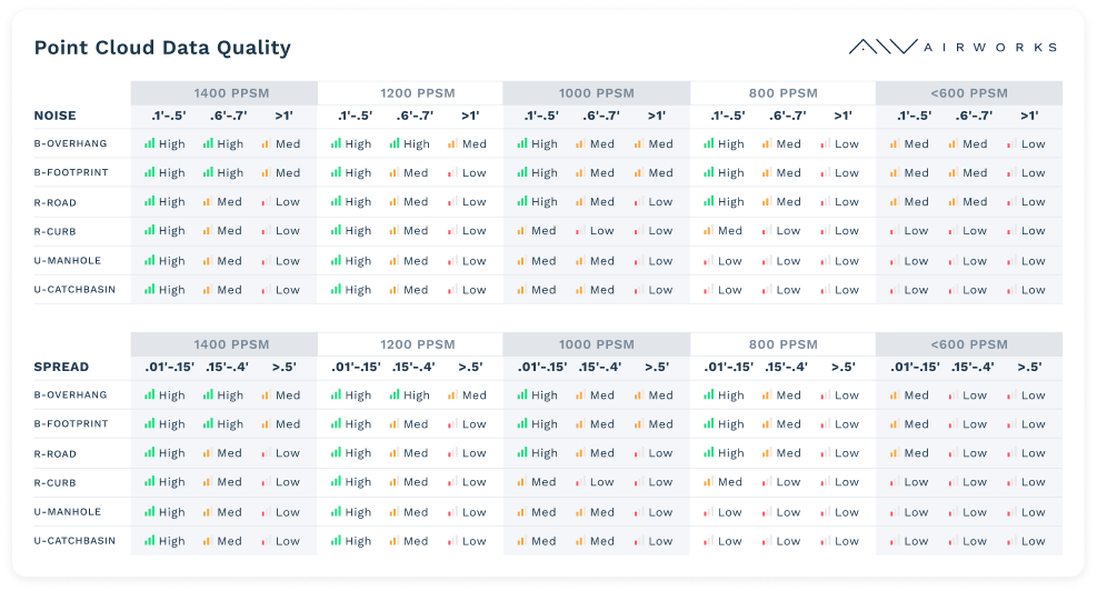
Chart displaying point cloud data quality
To understand this from application point of view, after submitting the workorder form, you will be navigated to such quality workflow. Let’s see them below:
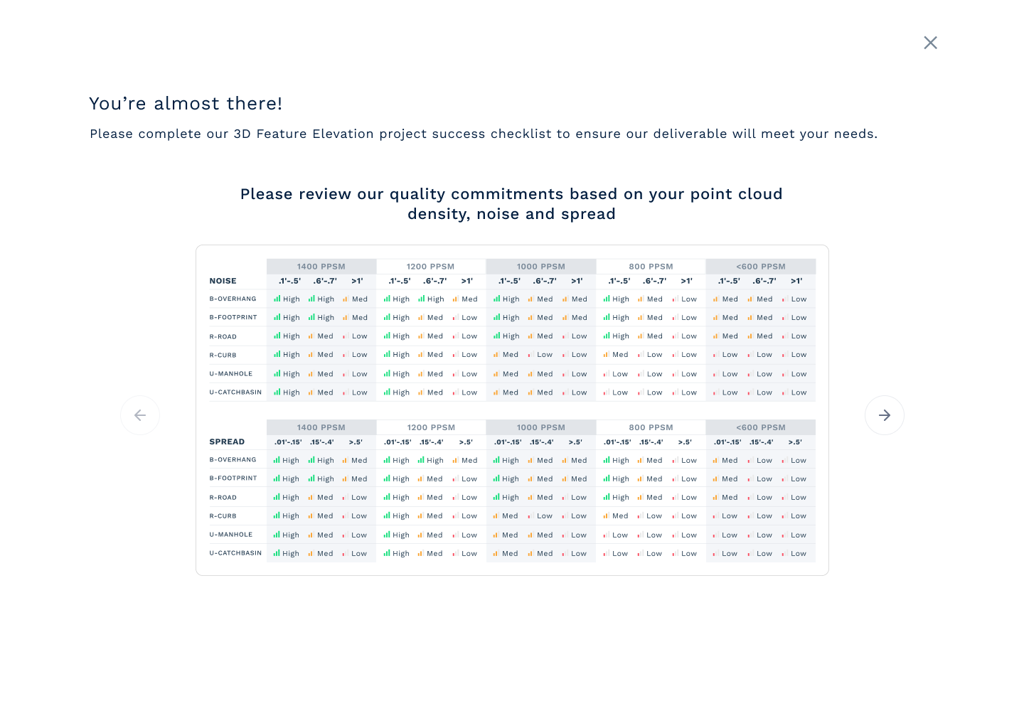
Point cloud quality (density, noise and spread) chart
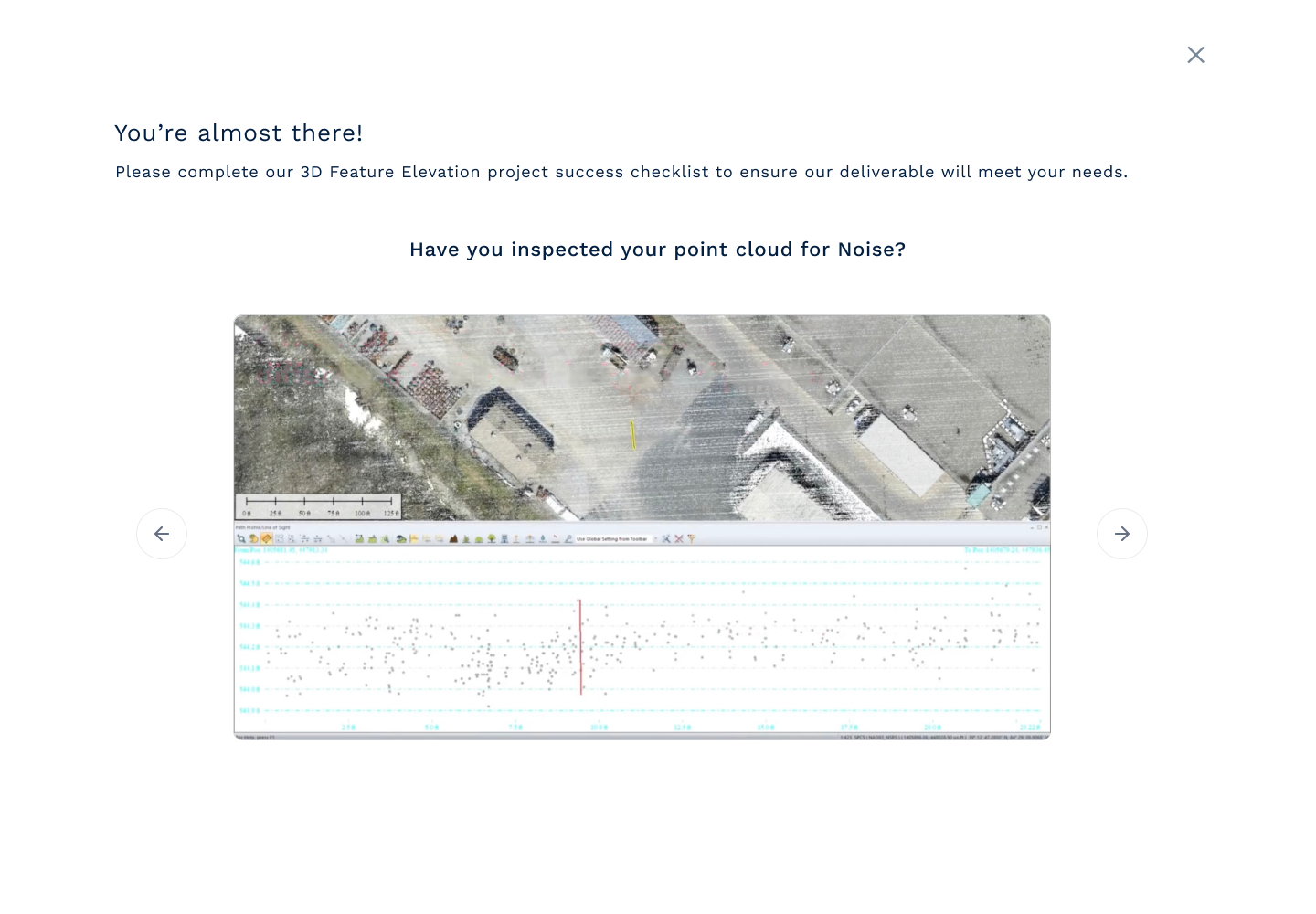
Noise Inspection
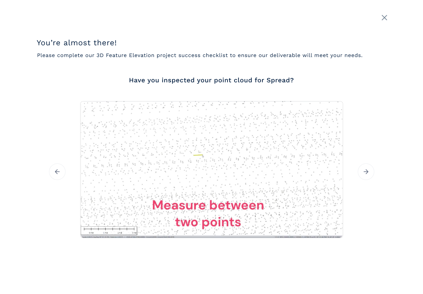
Point cloud spread inspection
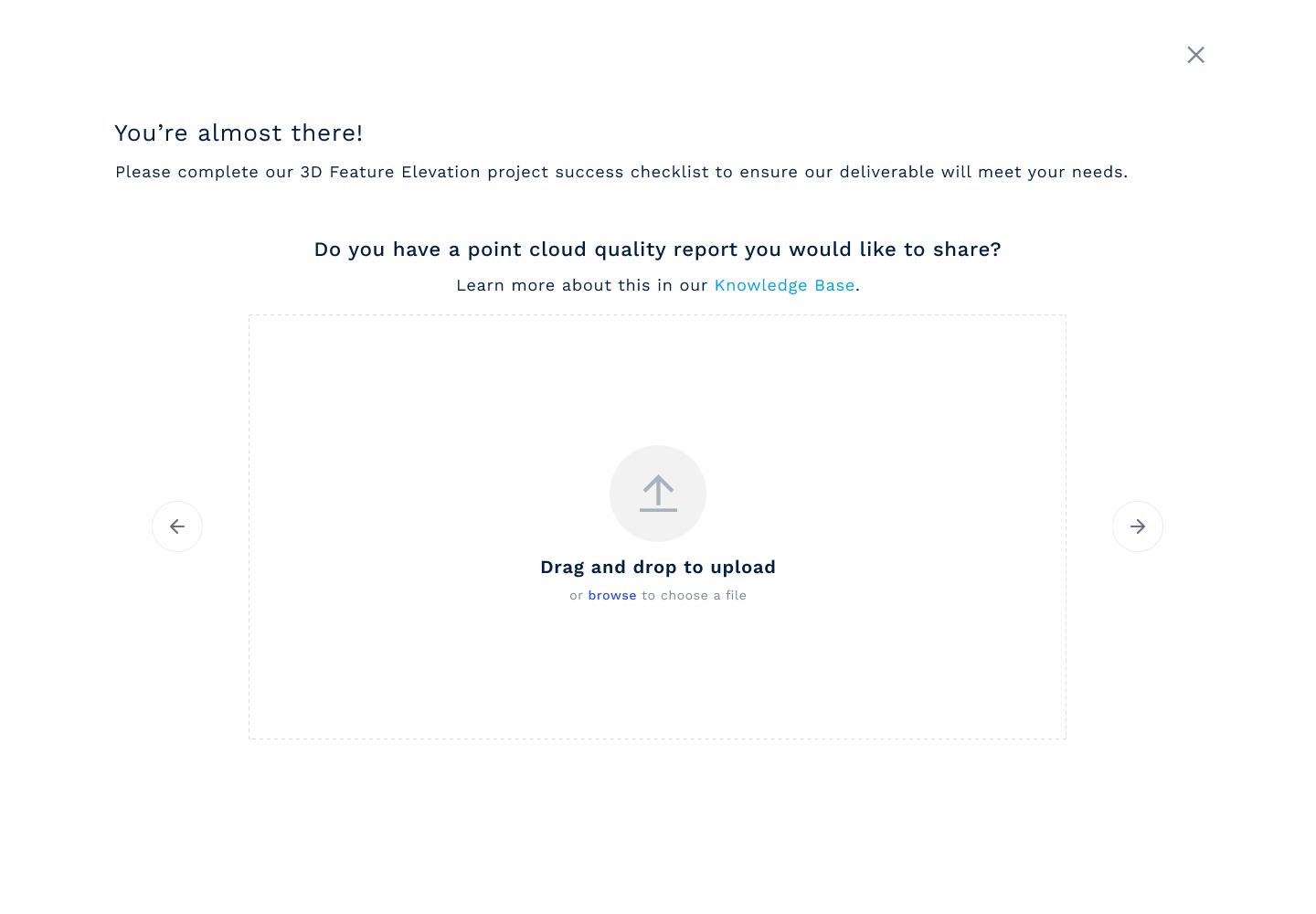
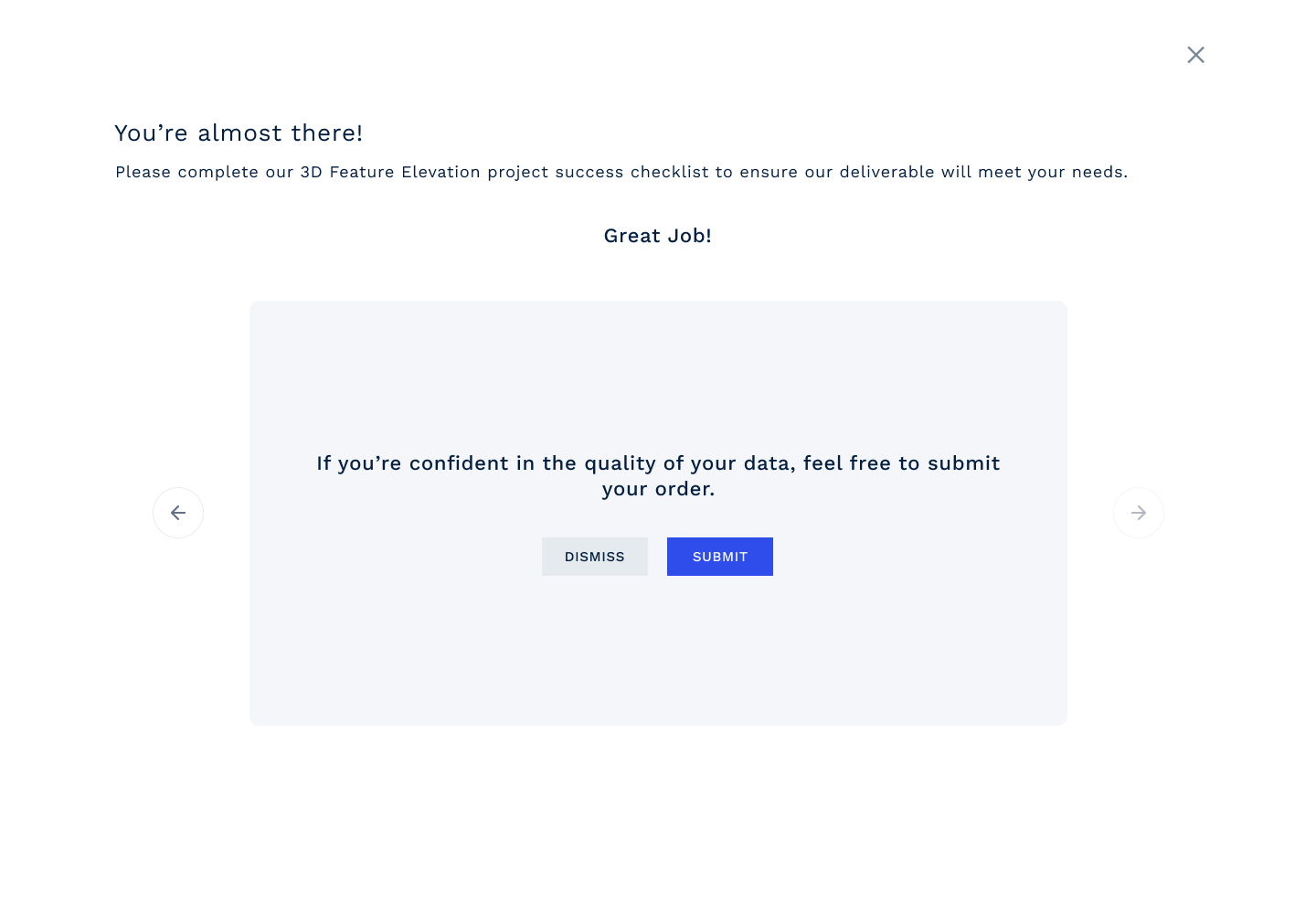
Final Submit
Lets now understand the flow of 3D Feature Elevation option:
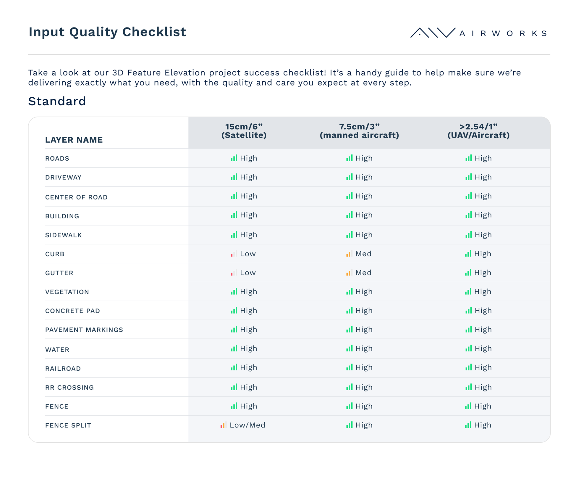
Standard layers
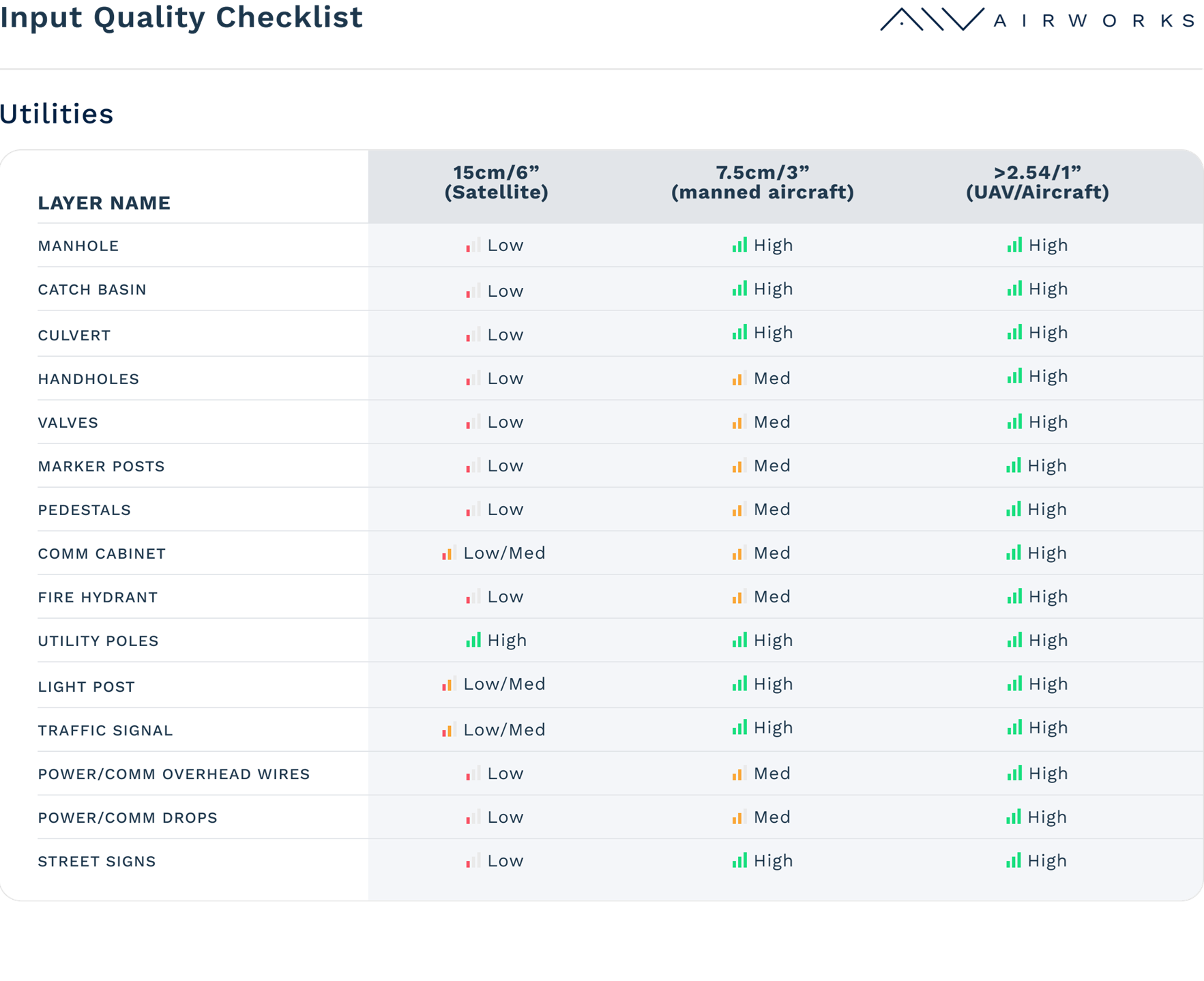
Utility Layers